The street
Cotleigh Road, Romford: An Overview
Cotleigh Road is a residential corridor in the London Borough of Havering, undergoing significant transformation due to the Elizabeth Line, Romford Town Centre Masterplan, and the Waterloo Estate regeneration. The page provides information on house values, with a median estimate of £446,000, and offers research on the road's history, demographic profile, and planning frameworks. The site aims to collect research on Cotleigh Road in one place, providing a detailed analysis of the area's development and property market.
Updated 3 min read
- Cotleigh Road is undergoing transformation due to infrastructure developments
- Median house value is £446,000
- 50 houses have automated valuation estimates ranging from £404,000 to £537,000
- The site provides research on the road's history, demographic profile, and planning frameworks
- The Elizabeth Line, Romford Town Centre Masterplan, and Waterloo Estate regeneration are driving change in the area
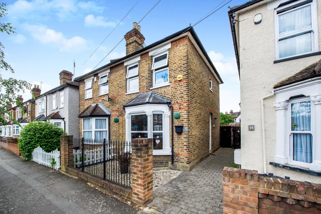
Cotleigh Road sits in the London Borough of Havering, immediately adjacent to the historic core of Romford and forming a boundary of the Waterloo Estate. It is a residential corridor in the middle of a substantial transition: from a historically static working-class enclave into a well-connected commuter destination.
Three forces are driving that change at once:
- The Elizabeth Line, which has compressed journey times from Romford Station — about 0.6 miles, a 10–13 minute walk — to Liverpool Street, Farringdon and Paddington.
- The Romford Town Centre Masterplan, formally adopted as a Supplementary Planning Document on 12 March 2025, identifying capacity for 10,900–12,000 new homes by 2041.
- The "12 Estates" regeneration, a £1 billion joint venture between Havering Council and Wates Residential, whose Waterloo Estate scheme runs directly along the western boundary of the road. The phase now approved and starting is 107 homes across Plots 9 and 10 — the blocks bordering Cotleigh Road.
What houses on Cotleigh Road are worth
The median house on Cotleigh Road is currently valued at £446,000. Fifty of the street's fifty-four houses carry a current automated estimate, each one read from the provider's own page rather than worked out here, and they range from £404,000 to £537,000.
| Median estimate | £446,000 |
| Middle half of the street | £439,000 – £454,000 |
| Full range | £404,000 – £537,000 |
| Houses valued | 50 of 54 |
Half the street sits within £15,000 of the median, which is a strikingly narrow band for fifty individually-modelled houses — and floor area turns out to explain almost none of the spread. Four pages set the numbers out in full:
- The valuation matrix — every address, both providers, Land Registry sale price alongside, with a source link on every row.
- What fifty valuations say about one street — the distribution, ranked, and why price per square foot barely works here.
- Growth since the last sale — what each house has gained since it last changed hands.
- Zoopla versus Rightmove — the two providers on the same thirty-nine houses, and the £96,000 they differ by at the extreme.
These are automated model estimates, not formal valuations, and nothing here is financial advice.
What this site covers
This site collects research on Cotleigh Road in one place: its history from Napoleonic barracks ground to present-day regeneration site, the demographic and connectivity profile of the RM7 postcode district, a property valuation matrix covering the road's housing stock, and a detailed reading of the statutory planning frameworks now being implemented around it.
A note on the analysis
The property and investment pages set out a view that the current pricing on Cotleigh Road has not yet fully absorbed the infrastructural changes scheduled for delivery over the next fifteen to twenty years. That is an interpretation of the evidence, not a certainty, and nothing on this site is financial advice. Valuation figures are automated model estimates, not formal valuations.